Here's a map of New York City from 1847. Notice that there are, of course, no bridges and all river crossings were done by ferry. The Greenpoint area of Brooklyn was known as Williamsburg (thus the Williamsburg Bridge). Straight roads dominate except for a few bended streets in the oldest section of lower Manhattan. Half of Broadway was called Bloomingdale Road, and the Harlem Railroad ran all the way downtown.
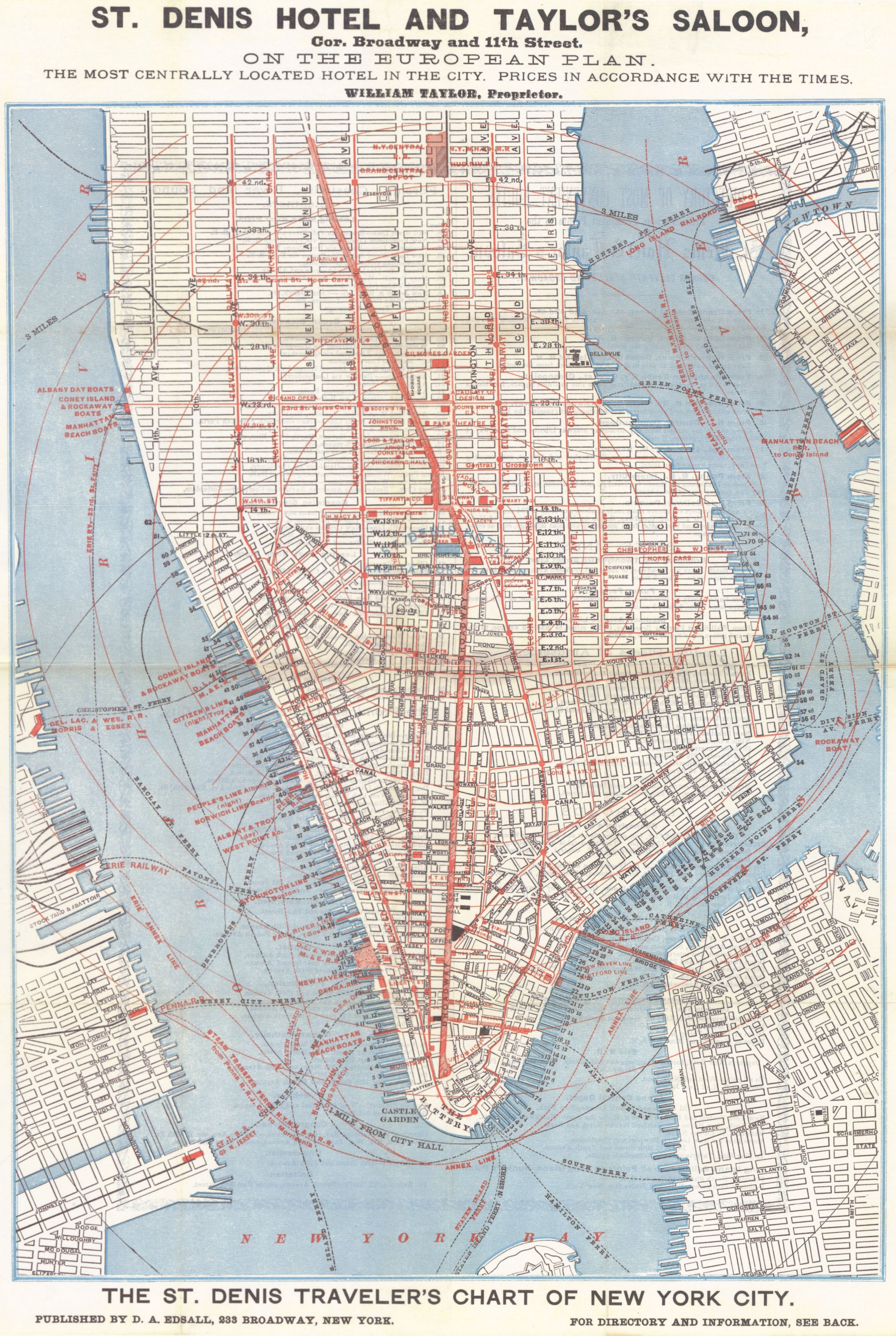
Here's a map from 1879 that offers way more detail. The Brooklyn Bridge opened four years after this map was drawn and it's marked as "Suspension Bridge" (it was officially named Brooklyn Bridge in 1915).
Finally here's a Google Maps view of New York City today. Notice the dominance of highways and tunnels, the reclaimed areas on the west side of Manhattan's tip in the Financial District, the reclaimed docks on Brooklyn's industrial shore, and the various holes in the Lower East Side where roads were closed off for housing developments. The Peter Cooper Village—Stuyvesant Town on the East Side at 14th St. and 1st Ave. is the largest. It was built in the mid-40s over the former Gastown District (where coal gas was processed) as a postwar housing project.
Also notice how the area around the Brooklyn and Manhattan bridge landings in Brooklyn reformed the streets. I was researching this old photo of the Daily Eagle Building a while back and had trouble figuring out if it still stood because the street in the photo no longer exists.

2.02.2009
Antique maps of New York City
Subscribe to:
Post Comments (Atom)

0 comments:
Post a Comment